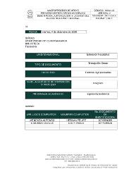
| dc.contributor.author | Mendoza Alfonso, Hernán Felipe | |
| dc.contributor.author | Carrero Ovalle, Lucy Paola | |
| dc.date.accessioned | 2021-05-05T20:13:00Z | |
| dc.date.available | 2021-05-05T20:13:00Z | |
| dc.date.issued | 2021-05-05 | |
| dc.identifier.uri | http://hdl.handle.net/20.500.12558/3439 | |
| dc.description.abstract | El presente trabajo se desarrolló con el objetivo de determinar la pérdida o cambio
de la cobertura vegetal a través de un análisis multitemporal a partir de imágenes
satelitales landsat 8 OLI/TIRS C1 Level-1 descargadas del geovisor Earth Explorer
del servicio geológico de los Estados Unidos (USGS) en la finca la esperanza en
Carcasí, Santander.
Se realizo a través de un proceso de interpretación haciendo uso de la clasificación
no supervisada en el software ArcGIS donde se pudieran determinar las coberturas
de interés en el año 2013 y 2020 con el fin de estimar el porcentaje de perdida de
cobertura vegetal en este lapso.
ABSTRACT
The present work was developed with the objective of determining the loss or
change of vegetation cover through a multitemporal analysis with satellite landsat 8
OLI/TIRS C1 Level-1 downloaded from the Earth Explorer portal of the United States
Geological Service (USGS) from La Esperanza farm in Carcasí, Santander.
It was done through an interpretation process using the unsupervised classification
in the ArcGIS software where the coverage of interest could be determined in 2013
and 2020 in order to estimate the percentage of plant coverage loss in this period. | es_CO |
| dc.description.sponsorship | Extensión Facatativá | es_CO |
| dc.language.iso | spa | es_CO |
| dc.relation.ispartofseries | TGAMFA;21157 | |
| dc.rights | Attribution-NonCommercial-NoDerivatives 4.0 International | * |
| dc.rights.uri | http://creativecommons.org/licenses/by-nc-nd/4.0/ | * |
| dc.subject | Analisis Multitemporal | es_CO |
| dc.subject | Cobertura del suelo | es_CO |
| dc.subject | Imagen satelital | es_CO |
| dc.subject | Clasificación de Coberturas | es_CO |
| dc.subject | Uso del suelo | es_CO |
| dc.subject | Perdida de Cobertura | es_CO |
| dc.subject | Multitemporal Analysis | es_CO |
| dc.subject | Landcover | es_CO |
| dc.subject | Satelital Image | es_CO |
| dc.subject | Landcover Classification | es_CO |
| dc.subject | Land use | es_CO |
| dc.subject | Landcover loss | es_CO |
| dc.title | Determinación De La Pérdida De Cobertura Vegetal A Través De Un Análisis Multitemporal En La Finca La Esperanza Ubicada En El Municipio De Carcasí – Santander | es_CO |
| dc.type | Trabajo de grado | es_CO |


